Oro Province

Location: Papua New Guinea
Coordinates: 8°45′56″S
148°14′05″
ECoordinates: 8°45′56″S 148°14′05″E
ECoordinates: 8°45′56″S 148°14′05″E
Country: Papua New Guinea
Province: Northern (Oro) Province
Districts: Ijivitari District & Sohe District
Elevation: 279 ft (85 m)
Time zone: AEST (UTC+10)
Main languages: Orokaiva, Tok Pisin, English
Popondetta, town eastern Papua New Guinea,
south-western Pacific Ocean. Popondetta or Oro as widely known is the capital
of Northern Province. The town, on a tributary of the Girua River, was an
Allied air base during World War II; the airfield is now used for civil
aviation. In addition, Popondetta is the focus of a road network 300 miles (500
km) long, extending from the port of Oro Bay to Kokoda, in the Owen Stanley
Range of the central highlands. The area produces cocoa, coffee, rubber, and
palm oil. There is some tourism centred on the nearby peaks, one of which,
volcanic Mount Lamington (20 miles [32 km] to the south), erupted in 1951, killing
3,000 people and destroying the town of Higaturu. Popondetta has a high school,
a vocational institute, and an agricultural college. Pop. (2000) 19, 556.
In
1951 the town became the focus of relief efforts after nearby Mount Lamington erupted and Popondetta was destroyed in January, 1951 when the long dormant volcanic Mount Lamington suddenly erupted.
 |
| Mt Lamington view from Girua aiport. |
At that time, the mountain was totally covered in green jungle forests and the locals were not even aware that it was a volcano. Only a few days after it began to 'burp', the mountain erupted in a massive explosion.
Pyroclastic flows of searing gas and ash flowed down the mountainside at 150-kph, killing everything in it's path up to almost 12-km out. It is believed that between 3000-4000 people were killed by the eruption.
Popondetta
is near to Buna on the Northern Papua coast and is
not far from the beginning of the Kokoda Trail, made famous during World War II.
This area of New Guinea is home to
the endangered Queen Alexandra's Birdwing, the world's largest butterfly.
 |
| Goliath bird wing butterfly |
Orokaiva
Identification."Orokaiva" is the
name for a number of culturally similar tribes in Papua New Guinea who speak
mutually intelligible dialects. Although the tribes did not have an inclusive
name for themselves until "Orokaiva" was introduced by Westerners,
they generally distinguished among themselves as the river people ( umo-ke),
saltwater people ( eva'embo), and inland people (periho).
Location.The Orokaiva reside in the Oro
Province of Papua New Guinea and are concentrated in the Popondetta district in
an area reaching from the coast at Buna Island to the northern slopes of Mount
Lamington and in the regions to the north of this general line. This area is a
humid tropical lowland, and uniformly high temperatures and rainfall provide a
year-round growing season. The wet season, from December to March, is
characterized by northeasterly or Northwesterly winds, high temperatures and
humidity, and late-afternoon thunderstorms, while the dry season, from May to
October, produces northeasterly winds, lower temperatures, less cloud cover,
and less-predictable rainfall.
Demography.The indigenous population of the
Popondetta district totals some 36,500, of whom 26,500 are Orokaiva in the
central lowland area. The number of Orokaiva at the time of Western contact is
not known.
Linguistic Affiliation.Orokaiva is classified
in the Binandere (or Binandele) Family of eight languages spoken in most of the
more densely populated parts of Oro Province. Orokaiva is spoken by about half
of the population in the Orokaiva-Binandere area. Dialect divisions within the
Orokaiva language area are minor; the boundaries of the area coincide with
those of the region administered by the Higaturu Local Government Council,
which covers the Saiho and most of the Sohe-Popondetta census divisions. While
there are considerable vocabulary differences between the Binandere Languages,
there is a close resemblance in grammar and enough similarity in vocabulary to
make a limited degree of communication possible.

KOKODA TRACK
 |
| Gateway to the famous Kokoda track |
The famous Kokoda Trail or Track is
a single-file foot thoroughfare that runs 96 kilometers (60 mi) overland – 60 kilometers (37 mi) in a straight line – through the Owen Stanley Range in Papua
New Guinea. The track was the location of the 1942 World War II battle between
Japanese and Allied – primarily Australian – forces in what was then the
Australian territory of Papua.
The track runs from Owens Corner in
Central Province, 50 kilometers (31 mi) east of Port Moresby, across rugged and
isolated terrain which is only passable on foot, to the village of Kokoda in
Oro Province. It reaches a height of 2,190 meters (7,185 ft) as it passes around
the peak of Mount Bellamy.The track travels primarily through the land of the
Mountain Koiari people.
Hot, humid days with intensely cold
nights, torrential rainfall and the risk of endemic tropical diseases such as
malaria make it a challenging trek. Hiking the trail normally takes between
four and twelve days; the fastest recorded time is 16 hours 34 minutes.
History
The track was first used by European
miners in the 1890's to access the Yodda Kokoda goldfields. Between July 1942
and January 1943, a series of battles, afterwards called the Kokoda Track
Campaign, were fought between the Japanese and Australian forces. This action
was memorialized in the newsreel documentary Kokoda Front Line!, filmed by
cameraman Damien Parer, which won Australia's first Academy Award for its director
Ken G. Hall in 1942.
 |
| The tracking route |
After the war, the track fell into
disuse and disappeared in many places. John Landy, the long-distance runner,
set a record of four days for the crossing using carriers and guides during the
1950's, and in 1964 Angus Henry, the art teacher at Sogeri High School, along
with two of his students, John Kadiba and Misty Baloiloi, set a new record
which was to stand until after the millennium by completing the journey in
three and a quarter days without guides, carriers or any signposts or bridges.
The Kokoda Track Foundation,
established in 2003, helps villages along the track with education and
healthcare. There is a proposal to turn the track into an Australian heritage
destination on a par with ANZAC Cove at Gallipoli. Creation of the heritage
area, is in part a response to the issue of an Australian gold mining company
wanting to mine on or near the track. As of 2007, the idea was backed by the
Australian government and Papua New Guinea's foreign minister.
In November 2007, Australian mining
firm Frontier Resources announced plans to divert a section of the track to
make way for a copper mine. The plan has the support of the local landowners
and the Papua New Guinean government but has been criticized by trekking operators.
The track has been closed numerous
times by villagers along the route in response to various grievances. In May
2009, villagers at Kovelo – near Kokoda village – blocked the track after
complaints that money collected from trekking fees was not being distributed
fairly.
Since 2001, there has been a rapid
increase in the number of people walking the track. Six
Australian trekkers have died from natural causes while attempting to walk the
track. Four of those deaths occurred in 2009, with two in the same week in
April and another two 8 days apart in September and October. The deaths have
sparked calls for mandatory fitness tests for all walkers before starting.
As popularity for walking the track
has increased, there have been calls for more regulation of trek operators with
some operators taking as many as 150 walkers in a group. In response the
Kokoda Track Authority has announced that from the beginning of 2010, tour
operators must have a commercial licence which will "address things such
as training requirements and first aid details".
In August 2009, the Kokoda Track was
the destination for a group of trekkers that were killed when their light
plane, Airlines PNG Flight 4684, crashed en route to Kokoda Station. All 13
people on board, including 9 Australian trekkers, were killed in the crash. As a result, the Australian Government committed $1.8 million to improve safety
along the track. Funds would be used to improve the safety of airstrips at Kokoda,
Menari, Kagi, Melei, Efogi, and Naduri, villages located along the track. A
second radio channel would also be installed to deal with emergencies and
maintenance work.

In October 2009, Mr. Don Vale became
the oldest Australian (at 83) to successfully complete the Kokoda Track.
In November 2009, Australian
paralympian Kurt Fearnley (born without the lower section of his spine completed
the track, crawling north to south, in 11 days. A multiple paralympic gold
medalist (T54 Marathon in Athens and Beijing), he used customized shin pads and
wrist guards. His journey was to raise awareness of men's health issues and was
inspired by the story of Corporal John Metson, who crawled the track for three
weeks, refusing the assistance of a stretcher on the grounds it would burden
his comrades.
There has been much debate in
Australia about whether it should be called the "Kokoda Trail" or the
"Kokoda Track". The monument at Owers Corner uses both terms:
"Track" on one side and "Trail" on the other.
"Kokoda Trail" was
gazetted as the official name of the route by the Australian administration of
Papua New Guinea in 1972.
The earliest mention of the route in
an Australian newspaper may be in The Argus on Wednesday 29 July 1942 in a map
when it refers to "the Buna Kokoda-Moresby track".
According to historian Stuart
Hawthorne, before World War II, the route was referred to as "the overland
mail route" or "the Buna road". He states that "Kokoda
Trail" became common because of its use in Australian newspapers during
the war, the first known instance being in Sydney's Daily Mirror on 27 October
1942.
 |
An old World War 2 relic outside Girua airport , popondetta
|
However, all three terms Kokoda
Track, Kokoda Trail and Buna-Kokoda road were commonly used during World War II
in Australian newspapers from September 1942.
The diary of the Australian Army's
2/33rd Battalion records the route being officially designated as the
"Kokoda Trail" in September 1942. The Australian Army has used
"Kokoda Trail" as a battle honour since 1957. The Australian War
Memorial (AWM) says that "trail" is probably of United States origin
but has been used in many Australian history books and "appears to be used
more widely".
 |
| Fuzzy wazzy angel |
Despite the historical use of
"Trail", "Track" gained dominance in the 1990s, with the
Australian Macquarie Dictionary stating that while both versions were in use,
Kokoda Track "appears to be the more popular of the two".
The track can be walked from either
direction. Some say that from Kokoda to Owens Corner is easier, even though in
that direction one must actually climb an extra 550 meters in height.
The track can take anything from 4
days to 12 days to complete, depending on fitness and rest time involved.
Locals are renowned for being able to regularly complete it in 3 days. The best
time to trek Kokoda is from April to September, during the 'dry' season.
There are a number of guesthouses
located along the way, some at villages and others at traditional rest spots.
The main villages passed through (from Owers Corner) are Naoro, Menari, Efogi
Creek 1 & 2, Kagi or Naduri (if shortcut is taken), Alolo, Isurava, Hoi,
Kovolo. Villagers are increasingly taking part in the commercial opportunities
created by the growing number of tourists; in October 2006, some were known to
be selling cans of soft drink and beer at double the price payable in Port
Moresby.
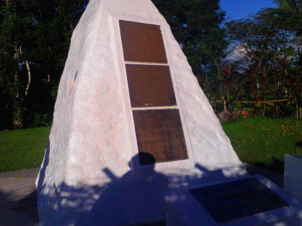 |
| War monuments at Kokoda |
Guides and porters can be found more
easily at the Kokoda end of the track by asking the local police station for a
reputable person.
The Kokoda Track Authority (the PNG
Special Purpose Authority with responsibility for managing the Track) requires
tour operators to hold a Commercial Operators Licence to lead treks along the
Kokoda Track and purchase a trek permit. Licensed operators carry first aid
kits, undertake first aid training, carry radios and/or satellite phones,
respect the people who live along the Track and ensure their porters and guides
are treated in a professional manner. A list of licensed operators is available
on its website.
Trekkers walking with unlicensed operators will be stopped
by the KTA Rangers and the local people.
https://www.facebook.com/groups/188784697877104/?
https://www.facebook.com/groups/188784697877104/?
This comment has been removed by the author.
ReplyDeleteThanks for your comment and will publish more for everyone.
DeleteThis comment has been removed by the author.
ReplyDelete